


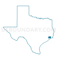
Voting District 0005, Chambers County, Texas
About
Outline

Summary
| Unique Area Identifier | 671436 |
| Name | Voting District 0005 |
| County | Chambers County |
| State | Texas |
| Area (square miles) | 207.75 |
| Land Area (square miles) | 49.79 |
| Water Area (square miles) | 157.96 |
| % of Land Area | 23.96 |
| % of Water Area | 76.04 |
| Latitude of the Internal Point | 29.72288610 |
| Longtitude of the Internal Point | -94.85088100 |
Maps


Graphs
Select a template below for downloading or customizing gragh for Voting District 0005, Chambers County, Texas


Neighbors
Neighoring Voting District (by Name) Neighboring Voting District on the Map
- Voting District 0001, Chambers County, TX
- Voting District 0003, Chambers County, TX
- Voting District 0004, Chambers County, TX
- Voting District 0006, Chambers County, TX
- Voting District 0008, Chambers County, TX
- Voting District 0010, Chambers County, TX
- Voting District 0011, Chambers County, TX
- Voting District 0088, Harris County, TX
- Voting District 0103, Galveston County, TX
- Voting District 0104, Galveston County, TX
- Voting District 0151, Galveston County, TX
- Voting District 0159, Galveston County, TX
- Voting District 0168, Galveston County, TX
- Voting District 0194, Galveston County, TX
- Voting District 0249, Harris County, TX
- Voting District 0333, Harris County, TX
- Voting District 0377, Harris County, TX
- Voting District 0414, Harris County, TX
- Voting District 0466, Galveston County, TX
- Voting District 0561, Harris County, TX
Top 10 Neighboring County Subdivision (by Population) Neighboring County Subdivision on the Map
- Texas City-League City CCD, Galveston County, TX (217,765)
- Southeast Harris CCD, Harris County, TX (89,788)
- Baytown CCD, Harris County, TX (72,734)
- Mont Belvieu CCD, Chambers County, TX (22,045)
- Anahuac CCD, Chambers County, TX (6,777)
- Bolivar Peninsula CCD, Galveston County, TX (2,417)
Top 10 Neighboring Place (by Population) Neighboring Place on the Map
- Pasadena city, TX (149,043)
- Baytown city, TX (71,802)
- Texas City city, TX (45,099)
- La Porte city, TX (33,800)
- Seabrook city, TX (11,952)
- Bacliff CDP, TX (8,619)
- San Leon CDP, TX (4,970)
- Beach City city, TX (2,198)
- Kemah city, TX (1,773)
- Shoreacres city, TX (1,493)
Top 10 Neighboring Unified School District (by Population) Neighboring Unified School District on the Map
- Clear Creek Independent School District, TX (210,500)
- Goose Creek Consolidated Independent School District, TX (99,072)
- Dickinson Independent School District, TX (51,434)
- Galveston Independent School District, TX (50,606)
- La Porte Independent School District, TX (41,528)
- Barbers Hill Independent School District, TX (14,411)
- Anahuac Independent School District, TX (6,780)
Top 10 Neighboring State Legislative District Lower Chamber (by Population) Neighboring State Legislative District Lower Chamber on the Map
- State House District 24, TX (181,472)
- State House District 129, TX (150,798)
- State House District 128, TX (148,817)
- State House District 23, TX (144,933)
Top 10 Neighboring State Legislative District Upper Chamber (by Population) Neighboring State Legislative District Upper Chamber on the Map
- State Senate District 17, TX (847,887)
- State Senate District 11, TX (838,090)
- State Senate District 4, TX (790,149)
Top 10 Neighboring 111th Congressional District (by Population) Neighboring 111th Congressional District on the Map
- Congressional District 22, TX (910,877)
- Congressional District 2, TX (782,375)
- Congressional District 14, TX (779,704)
Top 10 Neighboring Census Tract (by Population) Neighboring Census Tract on the Map
- Census Tract 7102, Chambers County, TX (15,543)
- Census Tract 7217, Galveston County, TX (7,937)
- Census Tract 7101, Chambers County, TX (6,502)
- Census Tract 3416, Harris County, TX (5,463)
- Census Tract 7218, Galveston County, TX (4,540)
- Census Tract 2539, Harris County, TX (4,416)
- Census Tract 2540, Harris County, TX (3,594)
- Census Tract 3436, Harris County, TX (3,317)
- Census Tract 7103, Chambers County, TX (2,890)
- Census Tract 3417, Harris County, TX (2,455)
Top 10 Neighboring 5-Digit ZIP Code Tabulation Area (by Population) Neighboring 5-Digit ZIP Code Tabulation Area on the Map
- 77521, TX (49,507)
- 77539, TX (38,806)
- 77520, TX (36,489)
- 77571, TX (35,666)
- 77586, TX (20,970)
- 77523, TX (17,031)
- 77518, TX (8,673)
- 77565, TX (5,790)
- 77597, TX (777)